Terrain profile analysis for HF takeoff
Last updated on 04/01/2009
My QTH is located in northwest Hungary on top of a ridge over the village of Györújbarát.
Geographical coordinates: 47.62° N 17.64° E (JN87TO)
This simple map shows the key feature of this QTH: being a highest ridge of three running paralel in NW/SE direction over a large plane in northwest Hungary it has an undisturbed view about 345 degrees around (170 - 185 degs azimuth is the ridge itself), overlooking the plane in a distance of 80 - 120 km.
For VHF contesting the 300-330 degs azimuth is the most important covering the most densely ham-populated but still reachable areas in DL and OK1. This azimuth range has uncluttered horizon with at least 100m effective height over 120-150 km.
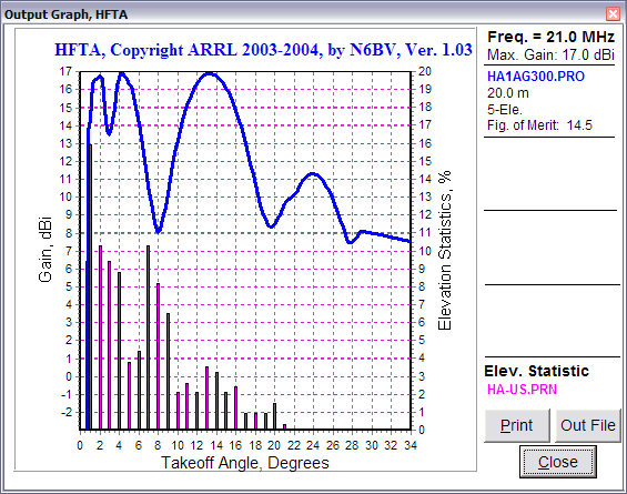
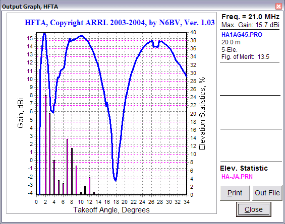
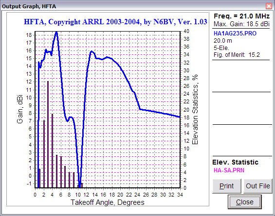
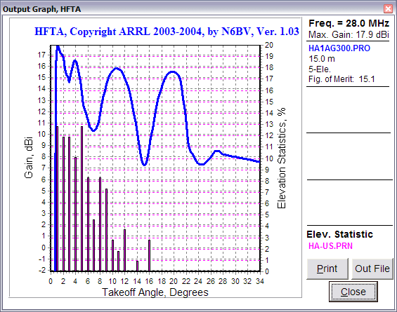
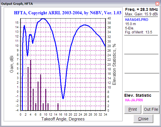
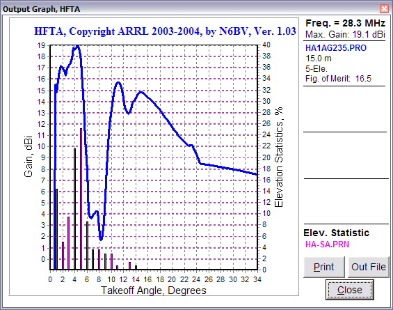
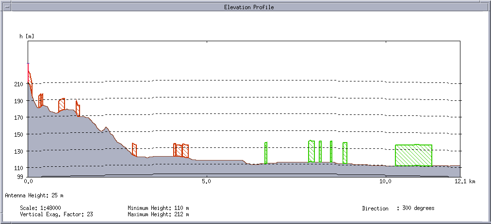
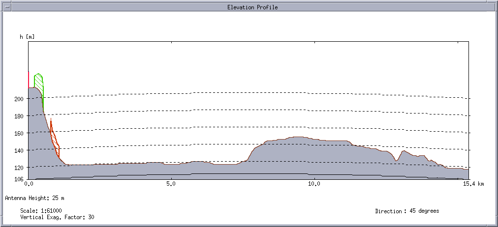
For HF I have made 3 terrain profiles: 300 degrees (USA), 45 degrees (Japan) and 235 degrees (Long Path to Australia).
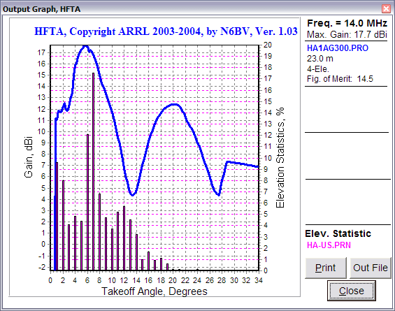
Terrain profile on 300 degrees azimuth (USA)
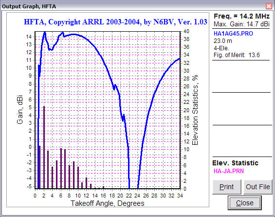
Terrain profile on 45 degrees azimuth (JA)
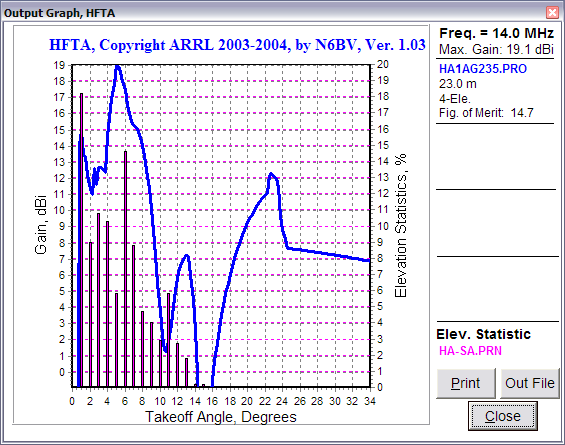
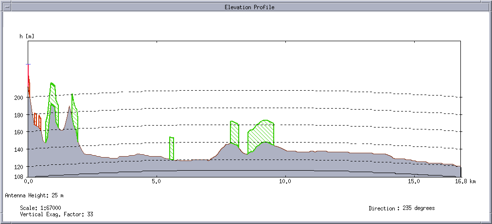
Terrain profile on 235 degrees azimuth (LP Australia)
On the 235 and on 45 azimuth profiles the neighboring two ridges can be seen. Fortunately they are far enough not to cause any problems. Dean N6BV has kindly supplied me with HA-centered propfiles for HFTA (this software is available via the ARRL Antenna Book) and using these data in HFTA I got the following result:
click on the thumbs to get the detailed graphs
|
|||||||||||||||||||||||||
Useful links:
Lat/Long <> IARU Locator Converter
EOV <> WGS84 (geographical) coordinate transfer (HA)
![]()